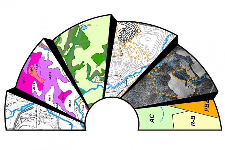
It is a technology applied to capturing, storing, analyzing, and visualization of spatial or geographic data. It integrates a lot of different data types so the end user will gain insight into patterns, relationships, and trends of spatial contexts. By mapping and analyzing this information, GIS (Geographic Information System) helps transform raw data into visual insights that drive better decision-making.
It plays a critical role in data collection and management from various sources, including satellite imagery and GPS, in addition to surveys. It allows the user to layer various datasets; thus, it visualizes geographic relationships and analyzes them; hence, useful in many applications.
What is GIS?
GIS (Geographic Information System) refer to the systemic, specialized techniques designed for capturing, managing, manipulating and displaying georeferenced information. It allows users to prepare and generate a variety of maps and charts, examine spatial connections and perform intricate tasks related to location. There is increasing significance and importance of GIS technology in aiding management strategies in urban planning, environmental management, agriculture, transport, and health sectors.
It bundles together disparate information typically obtained from various sources, for example, maps, databases, satellite images, and GPS units, which are necessary to extract better geographical information. These layers of information allow useful conclusions to be made on the observation of connections, structures, and tendencies that would not be seen in conventional data sets. Combining these data and graphic scenarios of this nature, the specialist is able to accurately model a location with the influence of a number of components.
Hardware, software, data, methods and people are the commonest components of the GIS. By the phrase hardware, it is common to understand or relate it to a computer system that is used to operate the GIS but more and more of the spatial data processing and analysis activities are carried out using software. Information is one of the most important components and comes from many sources including data captured by satellites, field research and even published reports. Methodology may provide an outline of the approaches a person can use and procedures that one should follow in the study.

2. Key Features and Functions of GIS:-
Implements, also known as GIS (Geographic Information System), refer to the systemic, specialized techniques designed for capturing, managing, manipulating and displaying georeferenced information. It allows users to prepare and generate a variety of maps and charts, examine spatial connections and perform intricate tasks related to location. There is increasing significance and importance of GIS technology in aiding management strategies in urban planning, environmental management, agriculture, transport, and health sectors.
It bundles together disparate information typically obtained from various sources, for example, maps, databases, satellite images, and GPS units, which are necessary to extract better geographical information. These layers of information allow useful conclusions to be made on the observation of connections, structures, and tendencies that would not be seen in conventional data sets. Combining these data and graphic scenarios of this nature, the specialist is able to accurately model a location with the influence of a number of components.
Hardware, software, data, methods and people are the commonest components of the GIS (Geographic Information System). By the phrase hardware, it is common to understand or relate it to a computer system that is used to operate the GIS but more and more of the spatial data processing and analysis activities are carried out using software. Information is one of the most important components and comes from many sources including data captured by satellites, field research and even published reports. Methodology may provide an outline of the approaches a person can use and procedures that one should follow in the study.
3. Applications of GIS in Different Sectors:-
It should be underlined that Geographic Information Systems technology establishes the most progressive management of data in various spheres, including spatial relations, and allows states-of-the-art management decisions; numerous industries apply it. In the context of urban planning and infrastructure, it might be regarded as highly vital since GIS facilitates the optimization of land use, plan new development, monitoring of urban growth. It, therefore, analyzes growth through an understanding of population density, infrastructure needs, and geographical constraints of areas so that cities can ensure the growth will be highly sustainable and that resources used are efficiently utilized.
It majorly relies on environmental management as a strong tool in the monitoring of climate change, tracking of deforestation, and management of natural resources of water and wildlife. It, therefore, helps governments and organizations analyze the environmental trends, estimate any challenges likely to happen in the future, and employ the proper conservation strategy in ways that protect ecosystems. In transport and logistics, this technology enhances route optimization, traffic management, and fleet tracking. Equipped with real-time traffic data, transportation companies reduce delivery time and cost while cities manage congestion and set up an efficient public transport system.
Disaster management, of course, is completely impossible to be effectively carried out without the predictive role of GIS in advance, whether that be a flood or an earthquake, enabling an effective response in case of any emergency. It enables the authorities to assess risks, map the vulnerable areas, and deploy resources effectively during emergencies. In agriculture, GIS facilitates precision farming by enabling farmers to monitor crop health, manage irrigation, and optimize resource use; this, in turn, increases yield while reducing the generation of waste and makes farming more sustainable.
Public health applies GIS (Geographic Information System) to disease tracking, modeling of epidemics, and the distribution of resources with the view to ensuring better responses by governments and health organizations to health crises. Business and marketing finally use GIS to enable firms to perform site selection and market analysis in finding out customer demographics and competition, and where the best locations for new ventures are.

4. Importance of GIS:-
Its abilities have been relied upon in such a high-quality fashion that, today it is classified to be one of the vital tools for decision making across numerous scopes via data insights into strategic decisions using geographic information systems. GIS combines data and allows organizations to visualize patterns of nonlinear variable relationships, thus making more informed decisions. Good asset allocation and utilization are critical regardless of whether you work in the public or private sector, so this will assist resource management.
In addition to strategic planning, GIS-related risk assessment and disaster preparedness obtained a substantial rating on the scale of importance for all hazards mapping. Agile situations ensure the operation of logistics and emergency services in real-time because GIS-driven data analytics streamline. Secondly, GIS provides support and interaction through maps and data are accessible to all stakeholders so that there can be a proper coordination of efforts. It helps eco-friendly development by giving contributions towards sustainability and conservation of environment. For this reason, it is one of the best defenses we have against these concurrent challenges.
5. Future Trends in GIS:-
With the ever-progressive development of obtainable Geographic Information Systems (GIS), artificial intelligence and machine learning are poised to change predictive analysis within GIST. AI algorithms are now also in use with GIS, allowing for analysis of massive volumes of spatial data to forecast trends and demand, resource optimization, signal undetectable correlations preemptively. This synergy improves decision-making throughout different fields, from urban planning to environmental management, and makes GIS even more strategic when predicting or reacting to intricate issues.
At the same time 3D GIS and virtual reality (VR) is shaping spatial visualization & planning growth. These developments put the geographic data in a three-dimensional model of it which make simulations and analysis accurate. Real-time GIS (also referred to as real time mapping) has been made possible because of widespread use of the Internet, such that data is more quickly and widely disseminated. The pervasive nature of IoT technologies & sensor networks brings even further utility with these depicting dynamic systems in modern times. With smart city and sustainable development initiatives gaining momentum, GIS will be the cornerstone in integrating and managing these complex technological solutions that are key to building efficient, resilient, and dynamic urban landscapes.

Conclusion:-
GIS (Geographic Information System) now a days used extensively in data manipulation and decision making, as it gives insight about spatial relationship with different layers on earth. Integrating more than 130,000 data sets and powerful analytical capabilities to support decision-making in a wide range of fields from urban planning to environmental management. The evolution of the technology makes GIS adoption even more important in order to get most out and bridge global challenges. Adopting GIS not only streamlines operations and enhances productivity, but also provides organizations with the ability to address complex problems more accurately and proactively. GIS, ever evolving in a rapidly changing world just makes it more important and an imminent transformative tool for future innovations.
Read more on:-
For more information about engineering, architecture, and the building & construction sector, go through the posts related to the same topic on the Pinnacle IIT Blogs page.
Find out more accurately what we are going to take off in the course of applying leading new technologies and urban design at Pinnacle IIT.
Subscribe to our YouTube channel and blog websites to obtain all the up-to-date information relating to construction matters.